Author: Cindy
-
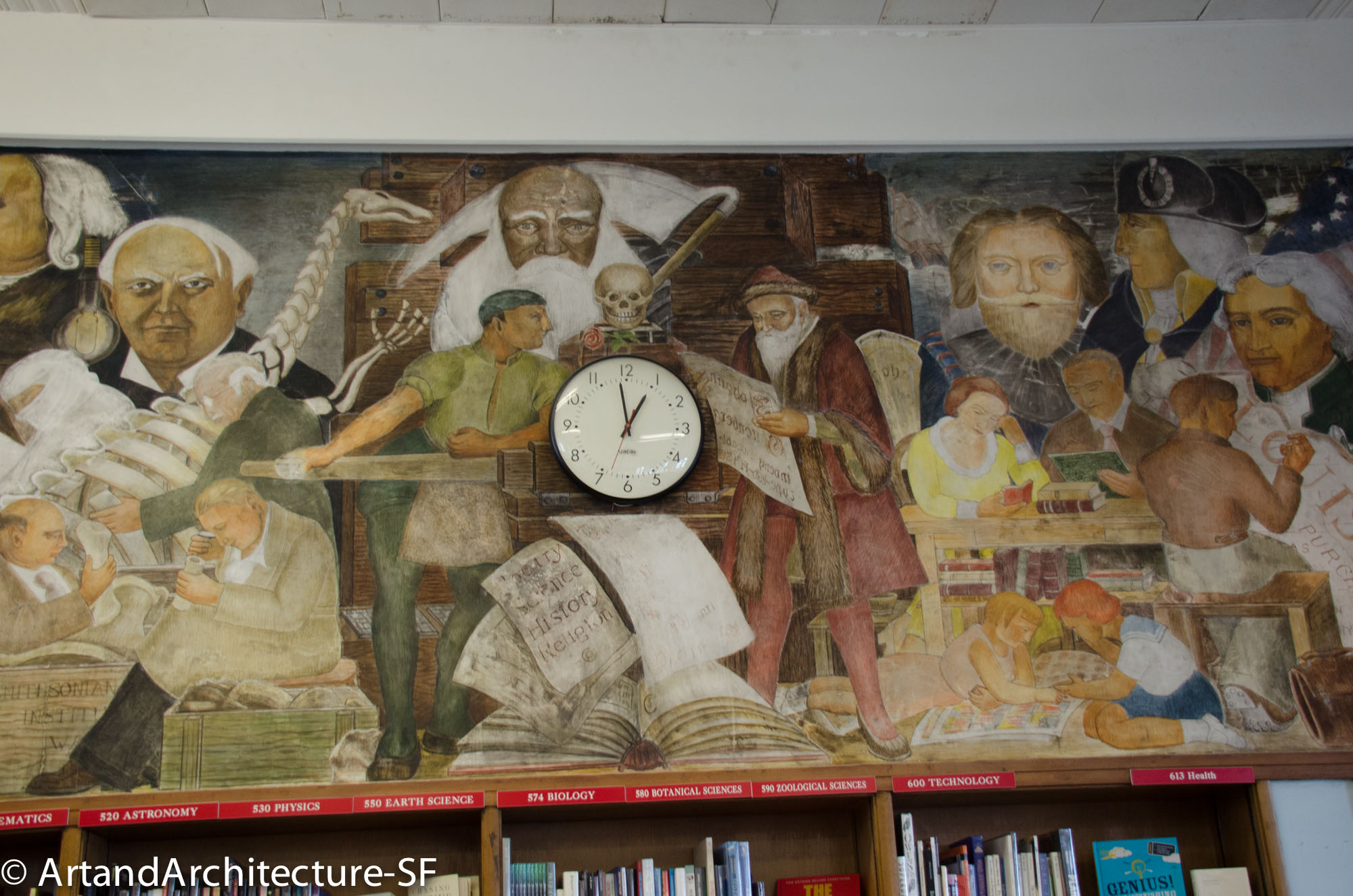
“Advancement of Learning through the Printing Press” by Lucien Labaudt
George Washington High School 600 32nd Avenue This mural, by Lucien Labaudt resides on the east wall of the library at George Washington High School it was completed in 1936 as part of the WPA. In this mural you will find such notables as Abraham Lincoln, George Washington, Junipero Serra, Benjamin Franklin, Thomas Alva Edison,…
-
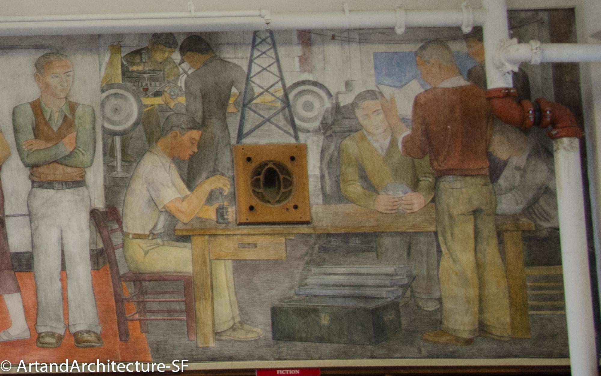
“Contemporary Education” by Ralph Stockpole
George Washington High Schoool 600 32nd Street Library Contemporary Education by Ralph Stackpole resides on the west wall of the library at George Washington High School. It was painted in 1936 as part of the WPA and the New Deal. Newspaper accounts at the time state that Stackpole was “interpreting contemporary education in the American…
-
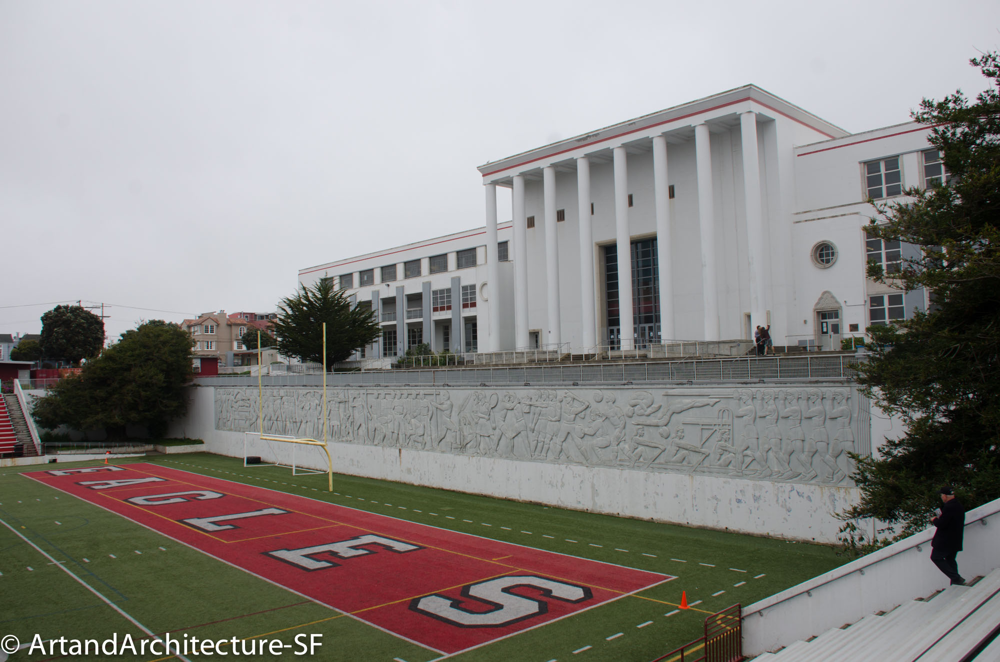
“Athletics” by Sargent Johnson
George Washington High School 600 32nd Avenue Football Field Originally awarded to San Francisco artist Beniamino Bufano, the commission for this work went to Sargent Johnson after Bufano was fired by the WPA when he proposed to use the Marxist labor leader Harry Bridges as a model in his iteration for the frieze. This 1942…
-
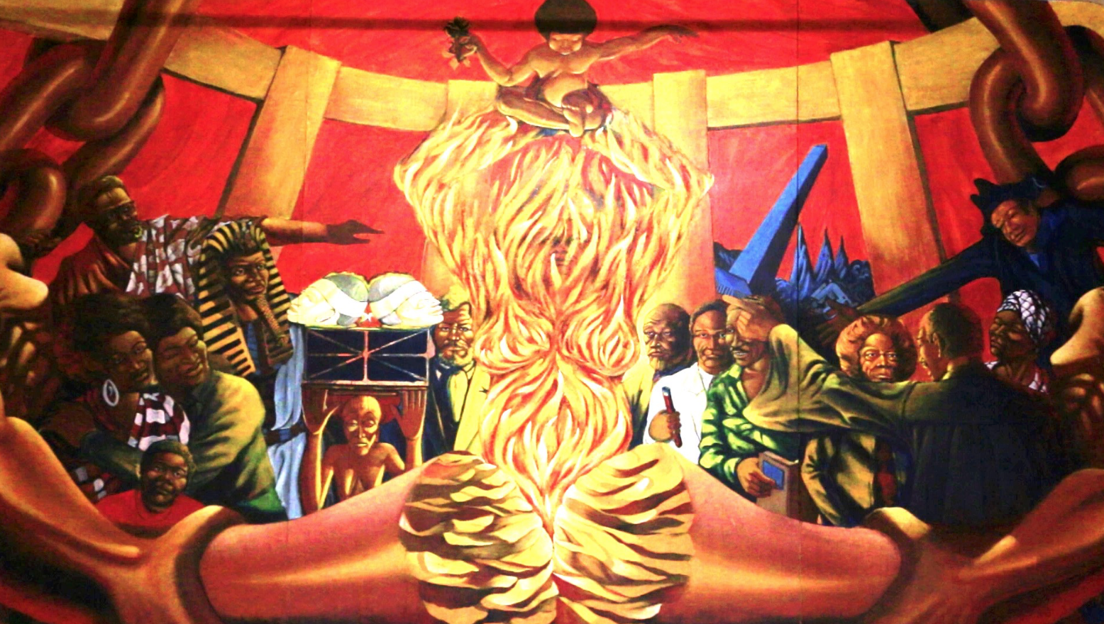
Dewey Crumpler at George Washington High School
George Washington High School 600 32nd Avenue This three panel mural by Dewey Crumpler is a direct response to the 1960s controversy over the Life of Washington murals. However, even these stirred controversy in their day, not with the subject, but with the artist. The Art Commission, and the students had far different opinions as…
-
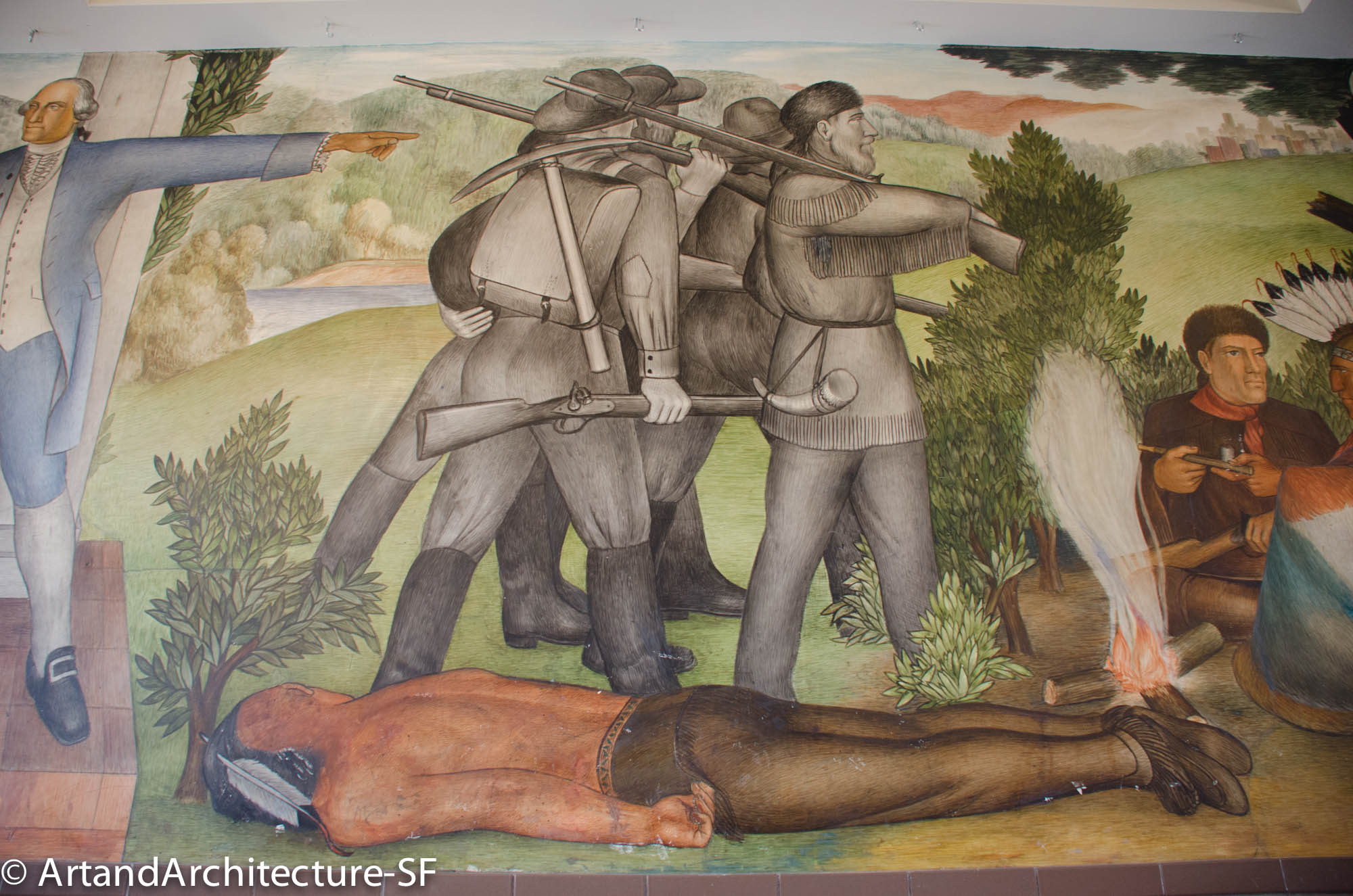
“Life of Washington” by Victor Arnautoff
George Washington High School 600 32nd Avenue Foyer This twelve-panel mural covers all the walls and the stairwell of the entrance to the main lobby of the school. Depicting the life of Washington it covers 1600 square feet. Painted in the “buon” fresco style, which consists of painting with pigments directly onto wet plaster, Arntauff…
-
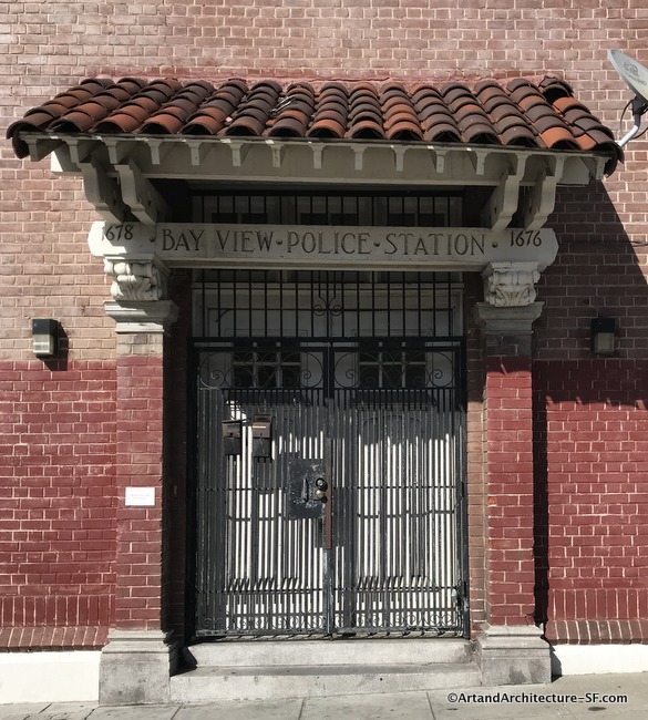
Bay View Police Station
1676/1678 Newcomb Bayview This old Bay View Police Station, with stables in the back, was built in 1911 in the Roman Renaissance style at a cost of approximately $22,000. Designed by city architect Alfred I. Coffey, it is sadly, not on any historical listing and is now in private hands. This police station was closed in the…
-
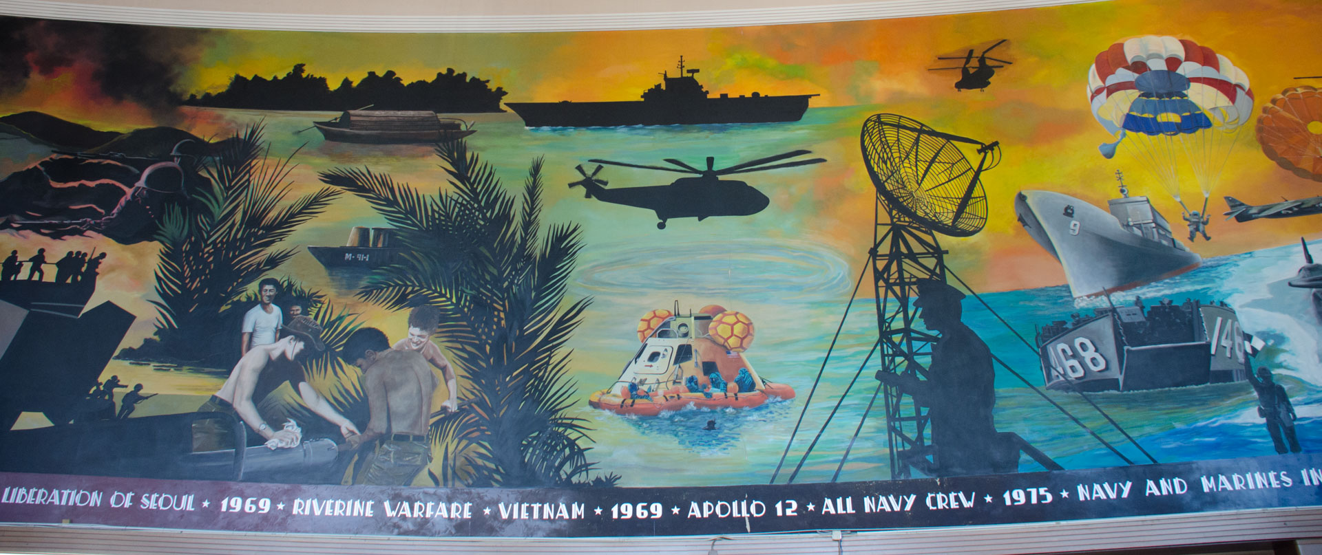
Treasure Island Museum Mural
Treasure Island Museum Former Administration Building Treasure Island This mural resides in what was originally called the Navy Museum inside the GGIE’s Administration Building. The museum opened October 3, 1975 with exhibits representing the Navy and Marine Corps from the early 1800’s to the present. Eventually the collection grew to include the Coast Gaurd and then…
-
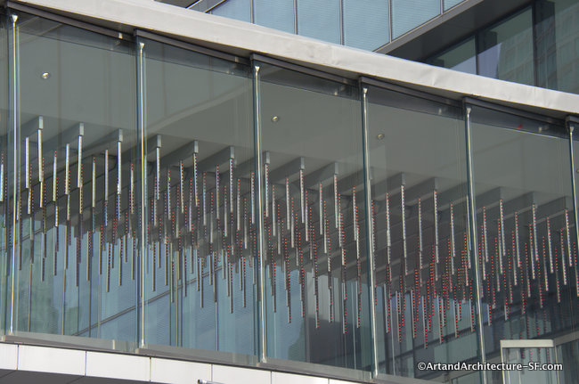
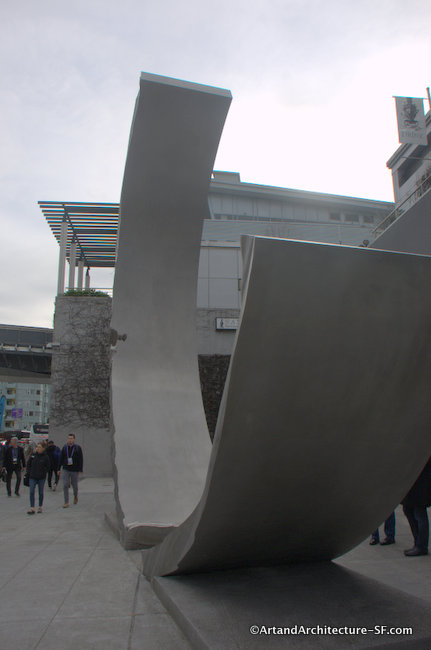
Point Cloud
Moscone Center “Point Cloud” by Leo Villareal, the designer of “The Bay Lights” on the Bay Bridge has been incorporated into the new East Bridge, which connects Moscone North and South. Commissioned by the San Francisco Arts Commission for $1.5 million, it is part of the city’ 2% for Art Program. This light sculpture is…
-
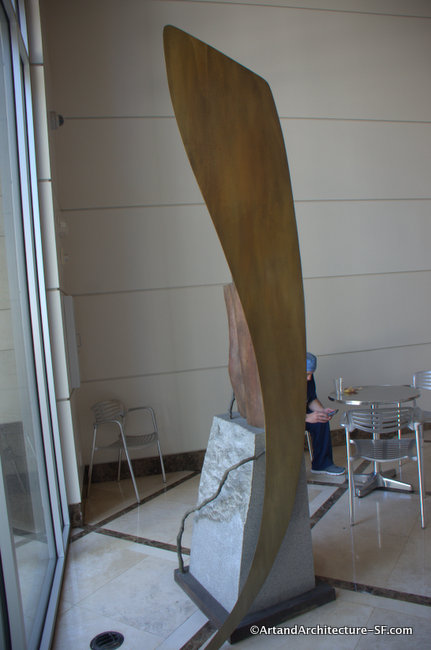
Geneses I at Moscone Center
Christine Corday was born in 1970 in Maryland. Before receiving her B.A. in Communication Arts (1992), she wrote an original research paper which led to an Astrophysics internship at NASA Ames Research Center. She went on to do graduate work in Cultural Anthropology and the works as a graphic and structural designer for advertising companies. Corday…
-
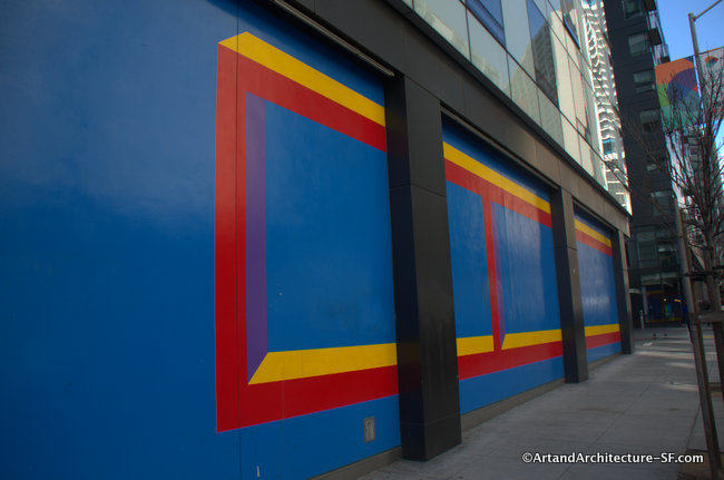
Wall Art #1012 on Mission
1400 Mission Street This artwork is part of San Francisco’s 1% for Art Program. The piece covers the façade at the corner of 10th Street and Jessie Street and is the height of the ground story, and spans approximately 66 linear feet of the facade along 10th Street and 27 linear feet along Jessie…
-
New Life at 77 Van Ness
77 Van Ness San Francisco Paul Gibson, born in Los Angeles in 1957, was educated at Cal Poly, San Luis Obispo, California, in Architecture, and received his BFA from the Art Center College of Design in Pasadena, California. Following his passion for arts, he decided to move to New York City and received…
-
Words Fly Away
Ocean View Branch Library 345 Randolph Street This is a fabulous piece for a library. John Wehrle imagined the library interior as a metaphor for a book. He covered the library in jumbled letters, words and pictures. According to the artist’s website: Created in 2004, Worlds Fly Away is a complete installation – floor to…
-
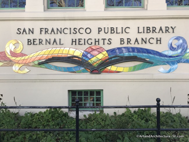
Art at Bernal Heights Branch Library
Bernal Branch Library 500 Cortland Avenue Reuben Rude of Precita Eyes Murals was chosen for this project. It was a difficult decision, as it replaced a mural that had been on the walls of the library for years. A recent renovation required the removal of the old mural which the current mural attempting to pay…
-
Full Circles
Visitation Branch Library 201 Leland Avenue This piece consists of interlocking steel hoops embellished with recycled bicycle gears and, according to Grieve, is intended to evoke a “universe of possibilities.” Mark Grieve (1965-) is a contemporary American artist. He studied painting and drawing at the San Francisco Art Institute and the College of Marin and apprenticed…
-
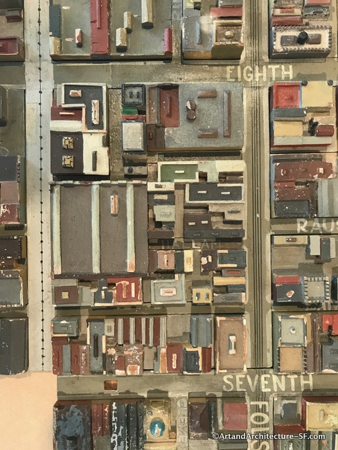
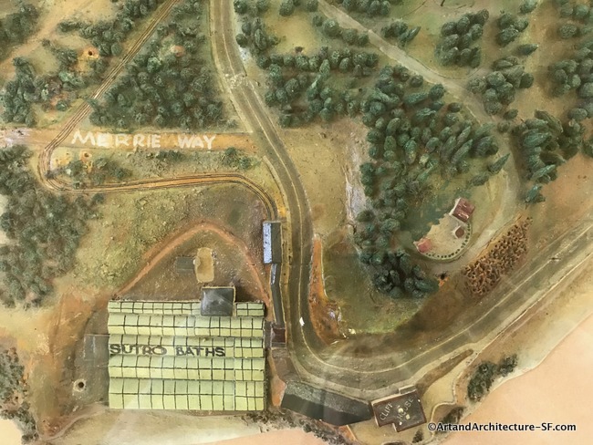
WPA Map of San Francisco
January to May 2019 At San Francisco’s Public Libraries This exhibit is something after my own heart. A WPA map of San Francisco combines my love of the projects that stemmed from the WPA and the history of San Francisco. This exhibit is called Take Part and more information about the locations of the parts…
-
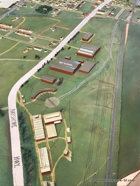
WPA Map of San Francisco Part 10 – Visitation Valley and Bayview Branch Libraries
Visitation Valley Branch Library Bayview Branch Library This is installment ten about the pieces of the WPA map that are being displayed as part of the joint program, Take Part, between SFMOMA and the San Francisco Library. You can read the first nine installments here. I apologize for the poor quality of the photographs.…
-
WPA Map of San Francisco -Bernal, Excelsior, Ingleside and Portola Branch Libraries
Bernal Branch Library Excelsior Branch Library Ingleside Branch Library Portola Branch Library This is installment nine of the pieces of the WPA map that are being displayed as part of the joint program, Take Part, between SFMOMA and the San Francisco Library. You can read the first eight installments here. I apologize for the poor quality…
-
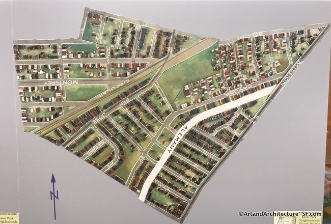
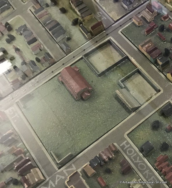
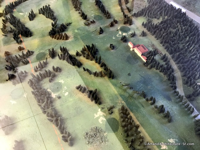
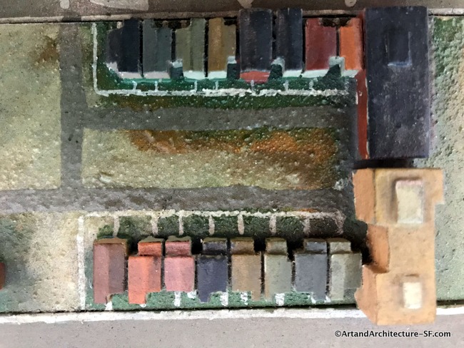
WPA map of San Francisco Part 8 -Ocean View and Glen Park Branch Libraries
Ocean View Branch Library Glen Park Branch Library This is installment eight about the pieces of the WPA map that are being displayed as part of the joint program, Take Part, between SFMOMA and the San Francisco Library. You can read the first seven installments here. I apologize for the poor quality of the photographs. Most…
-
WPA Map of San Francisco Part 7 – West Portal and Merced Branch Libraries
West Portal Branch Library Merced Branch Library This is installment seven about the pieces of the WPA map that are being displayed as part of the joint program, Take Part, between SFMOMA and the San Francisco Library. You can read the first six installments here. I apologize for the poor quality of the photographs. Most every…
-
WPA Map of San Francisco Part 6 – Sunset, Ortega and Parkside
Sunset Branch Library Ortega Branch Library Parkside Branch Library This is installment six of the pieces of the WPA map that are being displayed as part of the joint program, Take Part, between SFMOMA and the San Francisco Library. You can read the first Five installments here. I apologize for the poor quality of the photographs.…
-
WPA Map of San Francisco Part 5 – Richmond and Park Branch Libraries
Richmond Branch Library Park Branch Library This is installment five of the pieces of the WPA map that are being displayed as part of the joint program, Take Part, between SFMOMA and the San Francisco Library. You can read the first four installments here. I apologize for the poor quality of the photographs. Most every…
-
WPA Map of San Francisco Part 4 – Western Addition and Anza Branch Libraries
Western Addition Branch Library Anza Branch Library This is installment four of the pieces of the WPA map that are being displayed as part of the joint program, Take Part, between SFMOMA and the San Francisco Library. You can read the first three installments here. I apologize for the poor quality of the photographs. Most every…
-
WPA Map of San Francisco Part 3 – Golden Gate Valley, Marina and Presidio Branch Libraries
Golden Gate Valley Branch Library Marina Branch Library Presidio Branch Library This is installment three of the pieces of the WPA map that are being displayed as part of the joint program, Take Part, between SFMOMA and the San Francisco Library. You can read the first two installments here. I apologize for the poor quality of…
-
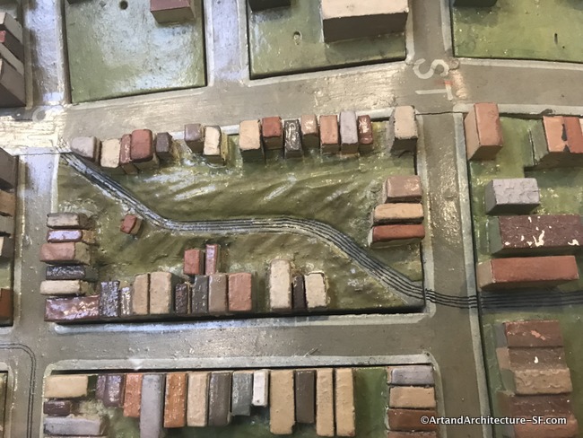
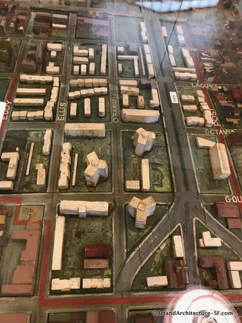
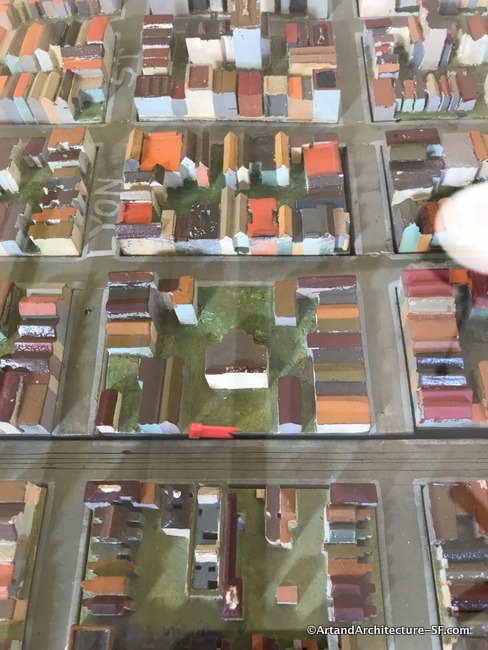
WPA Map of San Francisco – Part 2 – SFMOMA, Mission, Noe Valley and Eureka Valley Branch Libraries
SFMOMA Mission Branch Library Noe Valley Library Eureka Valley Library This is the second post in a series covering the joint SF Library system and SFMOMA project Take Part showing the map of San Francisco built by the WPA. Click here for Part 1 SFMOMA The hub of the San Francisco commuter bus and Greyhound…
-
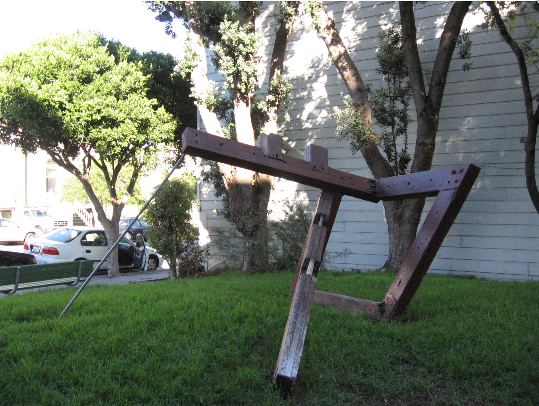
Paul Selinger piece is gone
This piece once stood in the Broderick and Bush Mini Park In 2010 the SFAC de-accessed this piece due to damage, one can assume it was destroyed. “Civic Art Collection Senior Registrar Allison Cummings informed the Committee of the need to remove Paul Selinger’s sculpture Untitled, 1971 (Accession #1971.44) from its current location at Broderick…
-

The Big Fish
The Big Fish also called The Salmon of Knowledge is a printed ceramic mosaic sculpture by John Kindness. The 33-foot long statue was constructed in 1999 and installed on Donegall Quay in Belfast, near the Lagan Lookout and Custom House. The Big Fish’s image regularly appears on tourism material related to Belfast and Northern Ireland.…
-
Spirit of Belfast
Cornmarket Arthur Square The Spirit of Belfast was unveiled in September 2009, this large-scale steel structure sits in the Cornmarket, where a bandstand once stood. The four interlocking rings sit in the heart of the city center’s pedestrianized shopping area and are said to have been designed to reflect Belfast’s shipbuilding and linen industries. Created…
-
Madhubani Paintings of Patna
These Madhubani paintings are going up all over Patna, Bihar. The project is aimed at beautifying the walls in the hopes that people don’t spit or urinate out in the open, on the walls. “Vulnerable points have been selected for the painting. However, work will continue on most of the walls. ” according to Patna Municipal…
-

Secret Garden
Transbay Terminal Second and Folsom Julie Chang is a San Francisco-based artist who, at the time of her selection, coincidentally lived within blocks of the Transbay Transit Center. Chang received her MFA at Stanford University in 2007. She also received an MFA Studio Award from the Headlands Center for the Arts in Sausalito in 2007.…
-

The Joker’s Chair
Joker’s Chair – Dermot Morgan Memorial (2002) By Catherine Greene The Joker’s Chair was erected in the memory of the Irish writer, actor, satirist and comic Dermot Morgan (1952-1998), The inscription which accompanies this piece reads; ….and all the rest is laughter liberating laughter to be remembered Catherine Greene was born in Galway and studied…