Category: Special Exhibitions
-
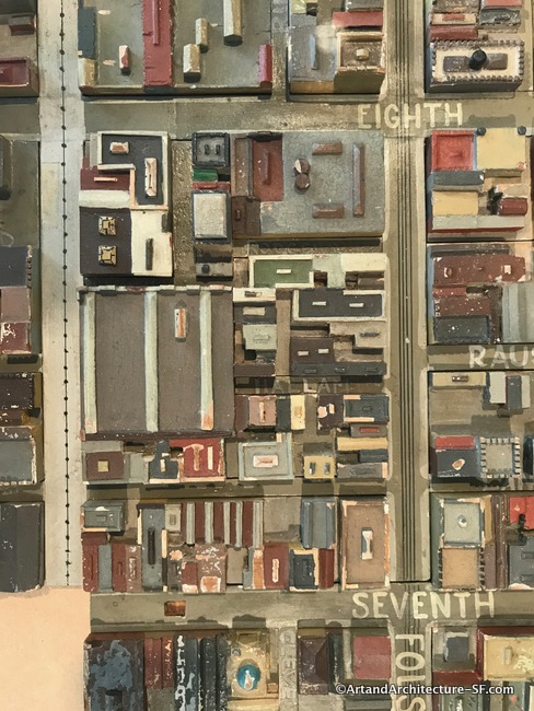
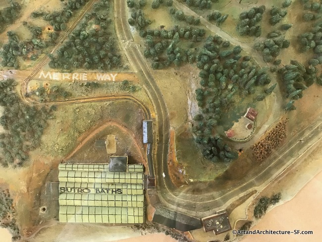
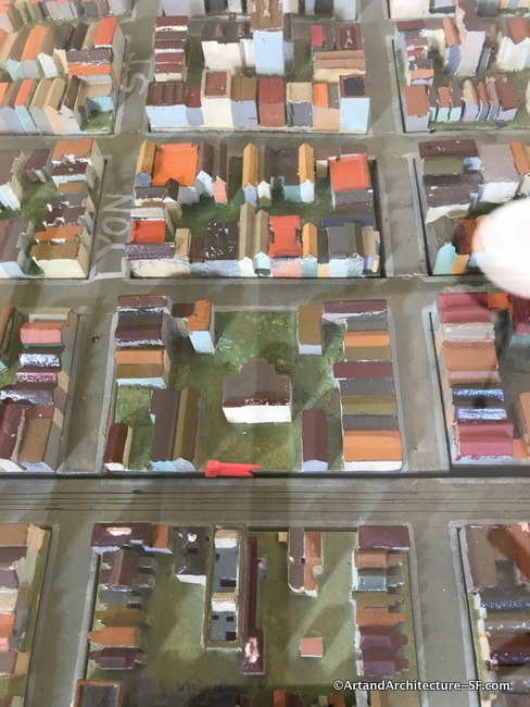
WPA Map of San Francisco
January to May 2019 At San Francisco’s Public Libraries This exhibit is something after my own heart. A WPA map of San Francisco combines my love of the projects that stemmed from the WPA and the history of San Francisco. This exhibit is called Take Part and more information about the locations of the parts…
-
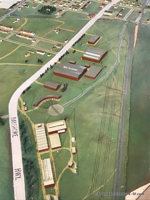
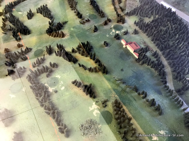
WPA Map of San Francisco Part 10 – Visitation Valley and Bayview Branch Libraries
Visitation Valley Branch Library Bayview Branch Library This is installment ten about the pieces of the WPA map that are being displayed as part of the joint program, Take Part, between SFMOMA and the San Francisco Library. You can read the first nine installments here. I apologize for the poor quality of the photographs.…
-
WPA Map of San Francisco -Bernal, Excelsior, Ingleside and Portola Branch Libraries
Bernal Branch Library Excelsior Branch Library Ingleside Branch Library Portola Branch Library This is installment nine of the pieces of the WPA map that are being displayed as part of the joint program, Take Part, between SFMOMA and the San Francisco Library. You can read the first eight installments here. I apologize for the poor quality…
-
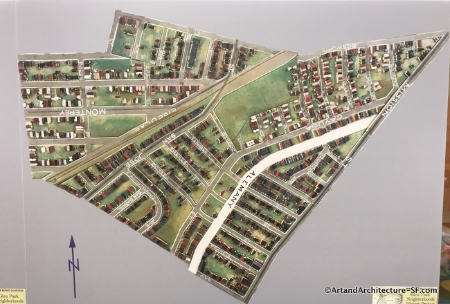
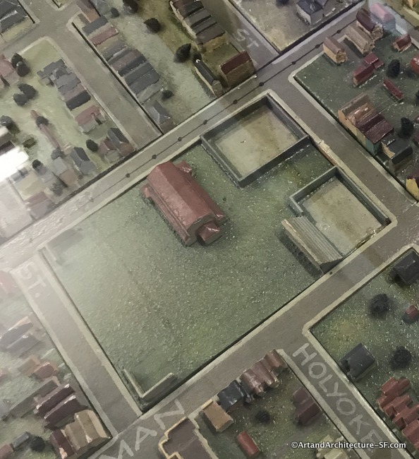
WPA map of San Francisco Part 8 -Ocean View and Glen Park Branch Libraries
Ocean View Branch Library Glen Park Branch Library This is installment eight about the pieces of the WPA map that are being displayed as part of the joint program, Take Part, between SFMOMA and the San Francisco Library. You can read the first seven installments here. I apologize for the poor quality of the photographs. Most…
-
WPA Map of San Francisco Part 7 – West Portal and Merced Branch Libraries
West Portal Branch Library Merced Branch Library This is installment seven about the pieces of the WPA map that are being displayed as part of the joint program, Take Part, between SFMOMA and the San Francisco Library. You can read the first six installments here. I apologize for the poor quality of the photographs. Most every…
-
WPA Map of San Francisco Part 6 – Sunset, Ortega and Parkside
Sunset Branch Library Ortega Branch Library Parkside Branch Library This is installment six of the pieces of the WPA map that are being displayed as part of the joint program, Take Part, between SFMOMA and the San Francisco Library. You can read the first Five installments here. I apologize for the poor quality of the photographs.…
-
WPA Map of San Francisco Part 5 – Richmond and Park Branch Libraries
Richmond Branch Library Park Branch Library This is installment five of the pieces of the WPA map that are being displayed as part of the joint program, Take Part, between SFMOMA and the San Francisco Library. You can read the first four installments here. I apologize for the poor quality of the photographs. Most every…
-
WPA Map of San Francisco Part 4 – Western Addition and Anza Branch Libraries
Western Addition Branch Library Anza Branch Library This is installment four of the pieces of the WPA map that are being displayed as part of the joint program, Take Part, between SFMOMA and the San Francisco Library. You can read the first three installments here. I apologize for the poor quality of the photographs. Most every…
-
WPA Map of San Francisco Part 3 – Golden Gate Valley, Marina and Presidio Branch Libraries
Golden Gate Valley Branch Library Marina Branch Library Presidio Branch Library This is installment three of the pieces of the WPA map that are being displayed as part of the joint program, Take Part, between SFMOMA and the San Francisco Library. You can read the first two installments here. I apologize for the poor quality of…
-
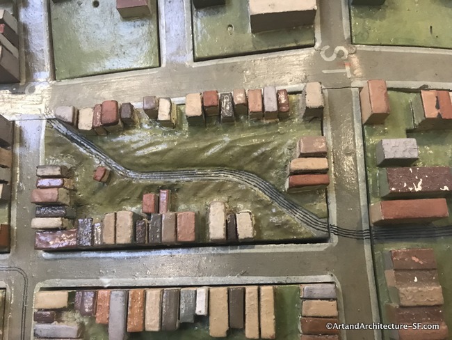
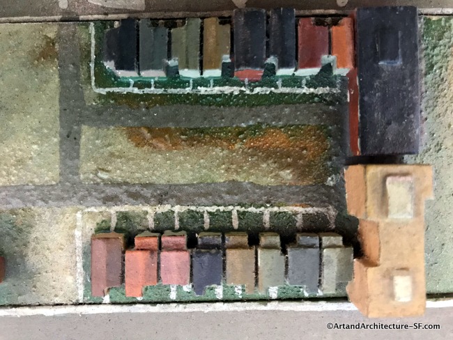
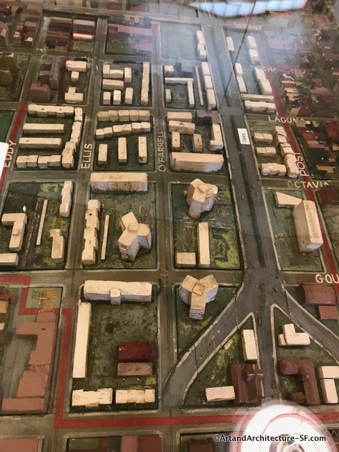
WPA Map of San Francisco – Part 2 – SFMOMA, Mission, Noe Valley and Eureka Valley Branch Libraries
SFMOMA Mission Branch Library Noe Valley Library Eureka Valley Library This is the second post in a series covering the joint SF Library system and SFMOMA project Take Part showing the map of San Francisco built by the WPA. Click here for Part 1 SFMOMA The hub of the San Francisco commuter bus and Greyhound…