Ocean View Branch Library
Glen Park Branch Library
This is installment eight about the pieces of the WPA map that are being displayed as part of the joint program, Take Part, between SFMOMA and the San Francisco Library. You can read the first seven installments here.
I apologize for the poor quality of the photographs. Most every model is under plexiglass and reflects not only the lighting from above but the light streaming in through the window.
Ocean View Branch Library
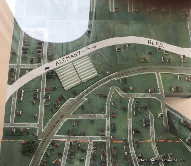
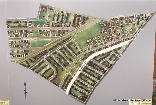
Niantic Street is now the Southern Freeway. On Niantic is a route of the Southern Pacific mainline into San Francisco. There will be much more about that at the Visitation Valley Branch Library.
The large white corrugated area is now a parking lot, they are listed as greenhouses on sheet 948 of the Sanborn maps.
In the center of the circle that is reached by Entrada and Court Streets is the famous Ingleside Sundial which you can read all about here. Urbano Drive was once the Ingleside Race Track.
Opened on November 28, 1895, by the Pacific Coast Jockey Club the Ingleside Race track consisted of an elegant clubhouse and a viewing stand. It is said that the horse stables were top notch. Somewhere between eight-to-twelve thousand people came on opening day and the Southern Pacific Railroad built a special line directly to the track.
The last horse race was on December 30, 1905. The track served as a refugee camp for many San Franciscans after the 1906 Earthquake and Fire.
In 1910 Urban Realty Development Company bought the old track and turned it into the residential area we see today.
Glen Park Branch Library
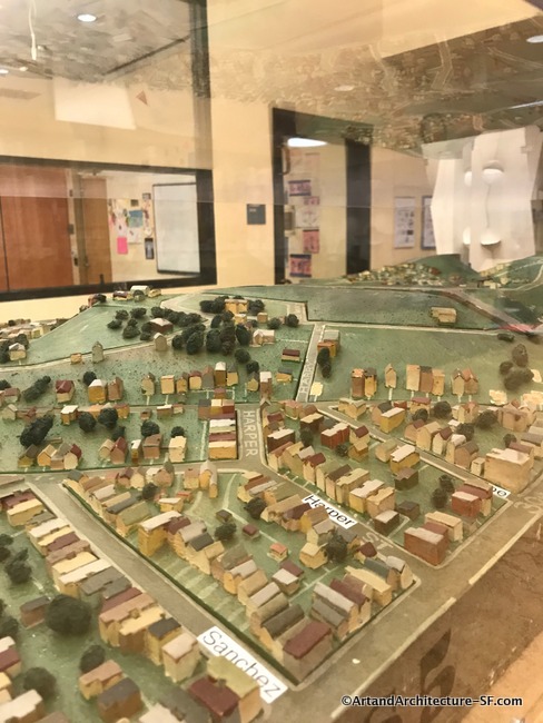
The map at the Glen Park Library is atop a bookcase so takes a small step stool to view, and it is hard to see the entire thing at one time, however, it does give you a fun view from the side.
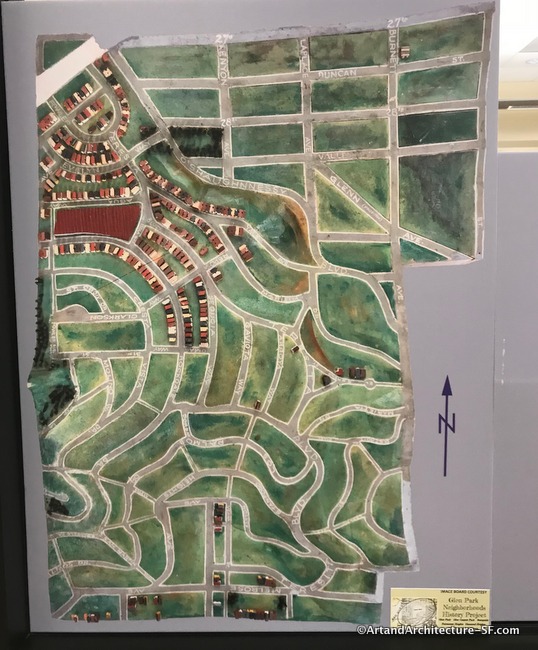
Notice the small building in Glen Canyon Park. It was the first dynamite factory in the US, the Giant Powder Company. The Giant Powder Company was incorporated in August 1867 by Julius Bandmann of San Francisco for the express purpose of manufacturing Nobel’s newly-patented explosive. The facility was constructed by early 1868, and production began in March.
On November 26, 1869, an explosion destroyed the factory, killing two and injuring nine people. A new facility was subsequently built in a remote location that is now the Sunset District (in the vicinity of today’s Kirkham, Ortega, 20th, and 32nd Avenues). Public outcry after an explosion at that plant forced the company to move to the East Bay.
As I mentioned in the last post, a few of the librarians are also putting up photographs of portions of the model that abut the portion that is on display. Here are three of the photos in the Glen Park Branch Library.
These photos were courtesy of the Glenn Park Neighborhood History Project, a wonderful resource for all that is Glenn Park.
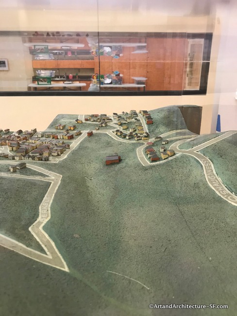
* The large red block is the Stanford Heights Reservoir.
Built in 1926 the Stanford Heights Reservoir was part of the development of a new water system for San Francisco after the 1906 earthquake. It sat on what at that time was the undeveloped northeast slope of Mount Davidson.
The undeveloped residential area in the above photo is Miraloma Park. It was developed from 1926 through the 1950s.
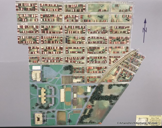
The large cluster of buildings on the bottom left of the above photograph is City College of San Francisco.
Please come back to this site as I will be writing about all of the maps that are in each of the San Francisco branch libraries.