Visitation Valley Branch Library
Bayview Branch Library
This is installment ten about the pieces of the WPA map that are being displayed as part of the joint program, Take Part, between SFMOMA and the San Francisco Library. You can read the first nine installments here.
I apologize for the poor quality of the photographs. Most every model is under plexiglass and reflects not only the lighting from above but the light streaming in through the window.
Bayview Branch Library
As I mentioned, often the light made it difficult to take pictures of the model. Sadly, at Bayview itwas actually impossible due to both overhead and window lighting.
During this time this area was home to many war dormitories which showed up on this section of the map. “The World War II era was arguably the most important period in the history of what is now the Bayview-Hunters Point district. Although the district had been steadily urbanizing during the 1920s and 1930s, the Navy’s takeover of the Hunters Point Dry Dock in 1939 set the state for a sustained industrial and residential building boom that would transform the outlying semi-rural district into a center of the worldwide Allied shipbuilding and repair arsenal. After Pearl Harbor, the Navy converted the dry dock into the Hunters Point Naval Shipyard, expanded it to encompass 979 acres of filled and unfilled land, six dry docks, 200 buildings, and 17 miles of railroad track. Meanwhile, the War Manpower Commission recruited thousands of predominantly African American workers from the Southwest and Deep South to work in important war industries. These migrants (both black and white) took up residence in the hundreds of hastily built dormitories erected on Hunters Point ridge, Double Rock, Islais Creek Channel, Candlestick, and several others. The period of significance for this theme is 1940 to 1945.” – From the Historic Context Statement for the SF Redevelopment Agency
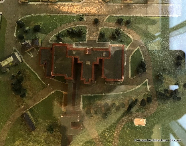
The building in the top photograph was the Roman Catholic Orphan Asylum.
The Catholic Sisters of Charity purchased the top of Mount St. Joseph in 1861 and opened an orphanage in 1869. The first building was a wooden structure with the grounds filled with horses. When the wooden structure burned in 1910, they replaced it with this brick one that had the capcity to hold 162 girls ages 5 to 18.
“Three or four girls share a bedroom and dine with other girls from their apartments,” The Chronicle reported. “Among the teen-agers radios blare, phonograph records spin, and the talk is just like the talk of other girls the same age.” – From the San Francisco Chronicle 1958
By the 1970s, the facility had begun offering residential treatment to young women. The orphanage building closed in 1977 and was sold to a developer. Homes began appearing on this vast piece of land in the early 1980s.
Visitation Valley Branch Library
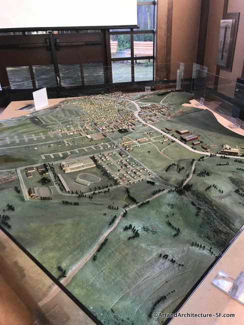
This particular map was without a doubt the best to visit. It is very large in scale giving you a wonderful sense of how fabulous the map in its entirety must be. It is also not covered in plexiglass making taking photos a real joy. It is in a locked room and open to the public between 5 and 6 pm. I would like to personally thank the librarian for letting me see the map during mid day.
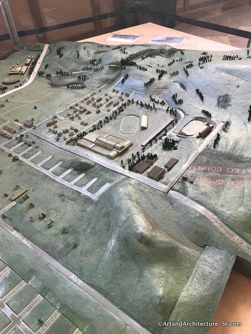
The idea for what was to become the Cow Palace was born at the 1915 Pan-Pacific International Exposition in San Francisco. When the fair’s huge livestock exposition proved to be one of its most popular attractions. In 1925, the San Francisco Exposition Company was formed to finance the project. Nineteen firms and individuals each contributed $20,000, and the land was purchased in the Marina District, the site of the 1915 fair… and then the depression hit.
In 1941, through the W.P.A. Program, the construction of the Cow Palace was completed in its present location.
Two weeks after the bombing of Pearl Harbor the building was rented by the Federal Government for $1.00 a year and for the next five years the huge structure was filled with troops embarking for combat zones in the Pacific Theatre. As World War II progressed, the pavilion was turned over to the Ordinance Department and converted into a repair garage. The building returned to its original use after the war.
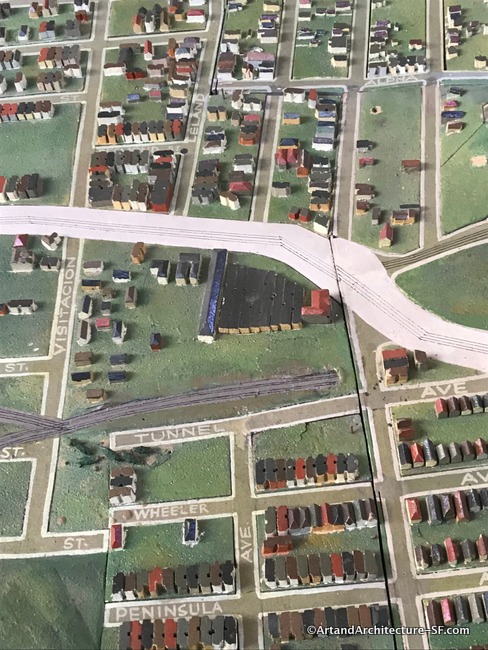
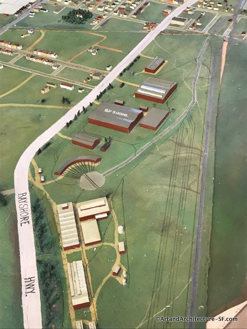 The Bayshore Roundhouse and steel turntable were built in 1910, after E.H. Harriman bought the property to create a more economical route into the yards of San Francisco by allowing trains to avoid San Bruno Mountain. The roundhouse served as a home and maintenance yard for steam-powered freight engines. At one point, there was the freight yard, shop and store buildings, 25 outbound tracks, 39 inbound tracks, and even a hospital for the 3,000 employees. The roundhouse was abandoned in 1982 well after diesel had taken over as a power source for trains. You can read more about the roundhouse here.
This is the last installation of the WPA map that is in each branch of the San Franciscso Public Library and SFMOMA. The event runs until March 13th, and it is absolutely worth your time to at least visit your local branch and see if you can find your own home, or just view the history of your own neighborhood.