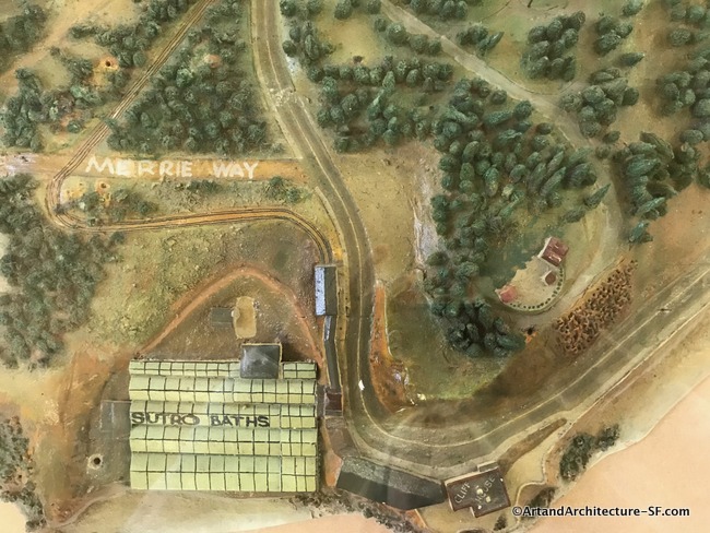
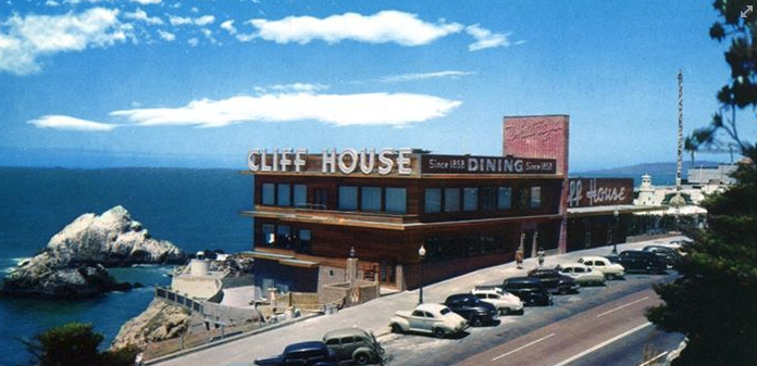
Cliff House
Land’s End
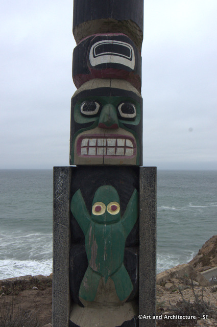
According to the San Francisco Public Library there was a small news copy regarding the totem pole when it was installed. The publication date was not noted but it appears to be April 28th, 1949.
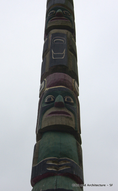
Newscopy: “Chief Mathias Joe Capilano of the Squamish Indians of Western Canada, he carve ‘um 58-foot totem pole for George K. Whitney to plant in front of Cliff House. Heap big pole, one of biggest in world, it marks Western end of pioneers’ trek. Smart, him pioneer. Him not march on into broad Pacific.”.
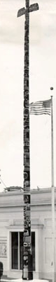 This is the photo that accompanied the article. Photo Courtesy of San Francisco Public Library.
A, shall we say, a politically more correct account was written in the Post Magazine in the 1950’s. It reads:
One bleak morning last year, when a bus~ load of tourists was glumly trying to see San Francisco’s famed Seal Rocks through an ocean fog, they were diverted by the arrival of a giant truck carrying a sixty-foot totem pole. It turned out to be the biggest totem pole in the world and was planted, with a few half-hearted war whoops, in front of the historic Cliff House Restaurant at the exact spot where P. T. Barnum once talked dreamily of training seals to ride horses side-saddle. The big pole was carved from a single cedar log by a Canadian Indian named Chief Mathias Joe, and almost before the first seagull came in for a landing, guides were explaining that the grotesque figures on it were Chief Joe’s tribal totems. This was sheer expediency because the carvings were not authentic Indian at all. They actually represent the immediate family and relatives of George Kerr Whitney, San Francisco’s shrewd and sometimes bizarre millionaire showman, who believes that people will pay to see anything if you tease ’em a little bit and keep it clean.
Those who know Whitney anticipate the early installation of a coin slot on the totem pole, which, for one small dime, the tenth part of a dollar, would make the carved figures light up and revolve to music, with an unreasonable facsimile of Whitney himself gaily whirling around the base. “I am the only genuine low man on a totem pole,” he says, dead-panned. Whitney loves this kind of whimsey, especially if it pays off, and apparently, it does. He owns the Cliff House, where seven United States Presidents have dined. The Cliff House Souvenir Shop, the largest in the world, and nearby Playland, the largest year-round amusement park in the
United States. Together these enterprises cover a nineteen-acre chunk of beach and bring him a gross of more than $3,000,000 a year and a reputation as the top outdoor-entertainment man in the world. Whitney would also have owned the Seal Rocks—and the sea lions on them—if Congress in 1887 had not deeded that landmark to the people of San Francisco in perpetuity. But Whitney fixed that, too, by installing telescopes on the Cliff House terrace, which…filling his pockets with 8000 dimes a month.
According to a history website, I found:
Chief Mathias Joe was a renowned carver and spirit dancer. In the early 1900s, Chief Mathias Joe began carving totem poles at a spot under the Lions Gate Bridge in British Columbia, where he lived until the early ‘50’s.
I found his obituary in the December 14, 1966, Montreal Gazette. It read:
One of British Columbia’s legends has become a part of history. Chief Mathias Joe, leader of the Capilano Indian band for more than 50 years, died in St. Paul’s Hospital Monday night at the age of 80.
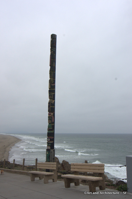
The World’s Largest Totem Pole, as can be seen in this photo taken in the 1950s. A storm shortened it to its present height during the 1950s.
It is not noted when it was moved to its present location on the left side of the Cliff House rather than the right as shown in the 1950’s photo.
 Many people come to San Francisco and head to the Musee Mecanique. There the first person you encounter, either with your ears or with your eyes is “Laughing Sal.” Well she wasn’t always in a museum.